April 19, 2024


SAN DIEGO (AP) — Firefighters struggling to control raging California wildfires faced a new threat Friday as a tropical storm approached from the south with gusty winds and a surge of moisture that forecasters warned could unleash heavy rains and flash floods.
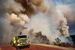
East winds were rising at the deadly Fairview Fire in Southern California and firefighters worried that gusts would push the fire west, casting embers far ahead and igniting new blazes.
The fire covered about 43 square miles of Riverside County and was just 5% contained. Two people died while fleeing on Monday and at least 12 structures have been destroyed. More than 18,000 homes were threatened.
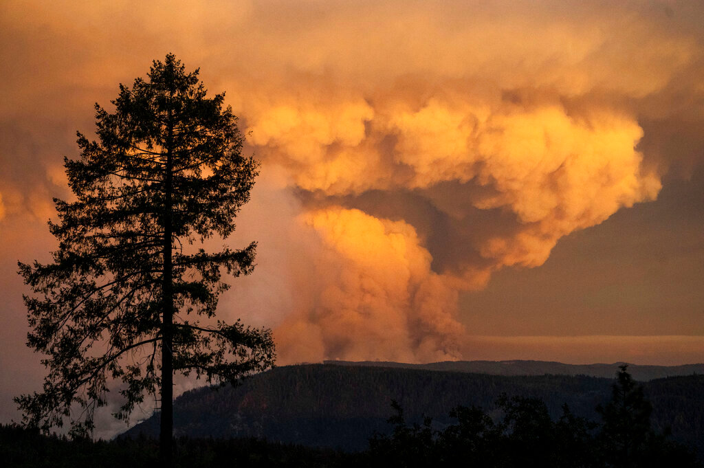
To the north in the Sierra Nevada, the Mosquito Fire burned out of control, scorching at least 22 square miles and threatening 3,600 homes in Placer and El Dorado counties, while blanketing the region in smoke.
Flames jumped the American River, burning structures in the mountain hamlet of Volcanoville and moving closer to the towns of Foresthill, home to about 1,500 people, and Georgetown, population 3,000. Fire spokesperson Chris Vestal called the fast-moving blaze an “extreme and critical fire threat.”
Stefani Lake evacuated her hilltop home near Georgetown on Thursday after sheriff's deputies knocked on doors telling people to get out. “The dogs are in the back of the car, I’ve got a room for the night, so I’m ready to leave,” Lake told the Sacramento Bee.
State emergency services officials warned that smoke was affecting air quality.
The fire’s cause remained under investigation. Pacific Gas & Electric notified the state Public Utilities Commission that the U.S. Forest Service placed caution tape around the base of a PG&E transmission pole but that no damage could be seen. PG&E said unspecified “electrical activity” occurred close in time to the report of the fire on Sept. 6.
Positive news was reported from the Radford Fire near the Big Bear Lake resort area in the San Bernardino Mountains east of Los Angeles. Evacuation orders were reduced to warnings as containment grew to 59% with just under 2 square miles burned.
California faced other weather threats as an oppressive heat wave strained the state power grid and tropical moisture brought a surge in humidity and threats of thunderstorms and floods.
Tropical Storm Kay, downgraded from a hurricane, was off Mexico's Baja California peninsula about 235 miles south of San Diego early Friday.
The system was expected to continue north and then veer west but still strongly impact Southern California. Gusty winds kicked up and the leading rain band moved into the state before dawn, the National Weather Service said.
“Living in San Diego, it’s odd to see skies overcast and rain and go outside into a wall of humidity as if it were South Carolina,” said city spokesperson Anthony Santacroce.
City officials were posting warning signs in low-lying coastal areas and making sandbags available to the public. Crews were on standby to deal with any flooding.
Fierce winds made driving to work difficult for Rhonda Young, office manager of the Julian Pie Company in Julian, a mountain town 60 miles northeast of San Diego that is known for its apple orchards.
“It’s pretty crazy out there,” she said. “There are definitely a lot of trees down.”
While the rain could help dampen some of the flames, it brings with it fresh risks.
Riverside County officials warned that some areas including wildfire burn scars could get up to 7 inches of rain, bringing threats of flash flooding and mud and debris flows.
“Based on forecasts, this appears to be a dangerous storm,” Bruce Barton, director of the Emergency Management Department, said in a statement.
Southern California Edison advised that it was considering cutting power to some areas due to the weather. Public safety power shutoffs are used to prevent fires from igniting if winds bring down or damage power lines and electrical equipment.
The changing weather was expected to finally end a scorching heat wave that has gripped the state for more than a week, but not before a final day of torrid conditions with little overnight relief. The weather service noted that the San Diego airport was 89 degrees at 5 a.m. Friday.
Operators of California’s power grid issued another “Flex Alert” call for voluntary cuts in use of electricity between 4 p.m. and 9 p.m., the hours when demand on the system is at its peak and solar generation is dropping off.
With record demand on power supplies across the West, California snapped its record energy use around 5 p.m. Tuesday with 52,061 megawatts, far above the previous high of 50,270 megawatts set July 24, 2006.
An emergency appeal for conservation that was sent to Californians’ cellphones was credited with an immediate drop in demand on the electrical grid Tuesday evening.


