April 27, 2024
LOS ANGELES (AP) — Heavy rain flooded roadways and much-needed snow piled up in the mountains on Thursday as the first of back-to-back atmospheric rivers pummeled California.
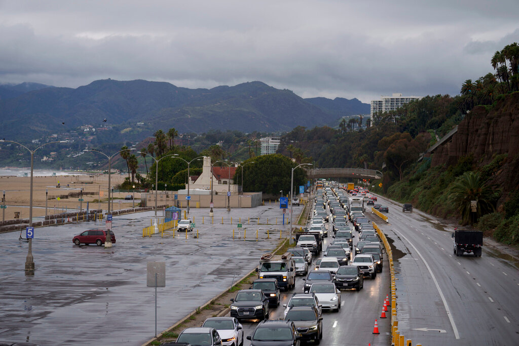
The storm focused its energy on the southern and eastern parts of the state after initially hitting the San Francisco Bay Area on Wednesday, where it halted cable car service. The downpours arrived in Southern California on Thursday in time to snarl the morning commute.
The Los Angeles and San Diego areas were expecting a deluge of rain on Thursday, “especially for some of the higher elevations where they tend to get most of the rainfall — or the heaviest rainfall — with these atmospheric river events,” National Weather Service forecaster Bob Oravec said.
An atmospheric river is an area where “the moisture is more confined and the winds are stronger and pushing these higher moisture values on shore,” Oravec said.
“They typically occur ahead of cold fronts across the Pacific,” he said. “And when they interact with the west coast topography, you often get some very heavy rain both along the coastal ranges and also inland through the Sierras.”
Last winter, California was battered by numerous drought-busting atmospheric rivers that unleashed extensive flooding, big waves that hammered shoreline communities and extraordinary snowfall that crushed buildings. More than 20 people died.
Last year's storms were on Joshua Whitby's mind Wednesday as he brought in sandbags and considered boarding up Zelda's on the Beach, a restaurant in Capitola, along Monterey Bay, were he is the kitchen manager. Forecasters also said the Central Coast could see waves up to 18 feet high on Thursday and Friday.
“There’s absolutely always a little bit of PTSD going on with this just because of how much damage we did take last year,” Whitby said.
This week's “Pineapple Express” — called that because its long plume of moisture stretched back across the Pacific to near Hawaii — will be followed by an even more powerful storm on Sunday, forecasters said.
The California Governor’s Office of Emergency Services activated its operations center and positioned personnel and equipment in areas most at risk from the weather.
Brian Ferguson, the office's deputy director of crisis communications, characterized the situation as “a significant threat to the safety of Californians.” He said an area stretching from the state's border with Oregon all the way south to San Diego and from the coast into the mountains could be affected over the next 10 to 14 days.
“This really is a broad sweep of California that’s going to see threats over the coming week,” Ferguson said.
On Thursday, southern Los Angeles County was hit hard by flash flooding. Vehicles plowed through water on low-lying sections of freeways and at least one underpass beneath a rail crossing in Long Beach was totally inundated, submerging a car.
To the southeast, a swift-water rescue team pulled a person from a flowing storm channel in Costa Mesa. The person was taken to hospital in stable condition, the Orange County Fire Authority said in a social media post.
In the Sierra Nevada, the Mammoth Mountain ski resort reported 12 to 14 inches of snow overnight. Earlier this week, state officials reported that the vital Sierra snowpack, which normally supplies about 30% of California’s water, was far below normal. Heavy snowfall was also reported in the mountains east of Los Angeles.
A winter storm warning was in effect through Friday morning for a nearly 300-mile stretch of the Sierra, from north of Lake Tahoe to south of Yosemite National Park, said the weather service office in Reno, Nevada. Snow could fall at rates up to 2 inches per hour in some areas, with winds gusting at up to 100 mph, forecasters said.
The second storm expected to move in Sunday has the potential to be much stronger, said Daniel Swain, a climate scientist at the University of California, Los Angeles.
Models suggest that it could intensify as it approaches the California coast — a process called bombogenesis in which a spinning low-pressure system rapidly deepens, Swain said in an online briefing Tuesday. The process is popularly called a bomb cyclone.
That scenario would create the potential for heavy but brief rain and a major windstorm for the San Francisco Bay Area and other parts of Northern California, Swain said.


